Esquema
barycentric coordinates
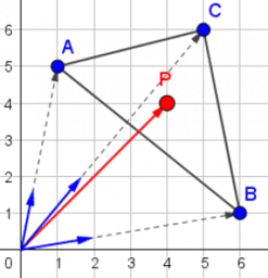
The position of a point can be described using coordinates. In a cartesian coordinate system the position of a point can be calculated as a linear combination of unit vectors on the coordinate axes. In polar notation a point is defined by its distance to the origin and a rotation angle, measured starting from the x-axis. But these two systems are not the only possible ones. In triangles thousands of remarkable points, called triangle centers, can be identified. For these points it's useful to take the verticles of the triangle as a reference instead of unit vectors on the axes. These verticles unambigously define the so called barycentric coordinates of a point.
In this GeoGebrabook you can learn more about these coordinates.
